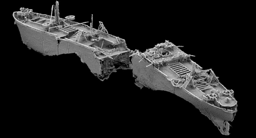
The SS Richard Montgomery shipwreck sank in the Thames estuary 1.5 miles north of Sheerness in Kent, UK in August 1944.

Location:
The SS Richard Montgomery shipwreck is situated 1.5 miles due north of the coastal town of Sheerness on the Isle of Sheppey in north Kent, UK.
The masts:
Three masts from the ship can currently just be made out by the naked eye at all tides from the shoreline.
Exclusion zone:
Due to the ship sinking with a large quantity of ammunition still onboard, the wreck is surrounded by an exclusion zone marked out by 4 large yellow marker buoys to the north, east, south and west of the site. Smaller red ‘Danger!’ buoys are positioned along the lines of the diamond shape formed by the yellow markers.
Monitoring:
All craft are prohibited from entering the exclusion zone, which is monitored 24/7 by radar and visual surveillance by the Port of Sheerness on behalf of HM Coastguard.
Official Survey Reports:
Can be found here: https://www.gov.uk/government/publications/the-ss-richard-montgomery-information-and-survey-reports/ss-richard-montgomery-background-information